Examples of Map-Based Quiz Games for Gamers and Educators
Discover engaging examples of map-based quiz games that blend learning and fun. Perfect for educators and gamers alike!
- examples of map-based quiz games
- interactive map games
- geography quiz examples
- educational map games
- map quiz game ideas
On this page
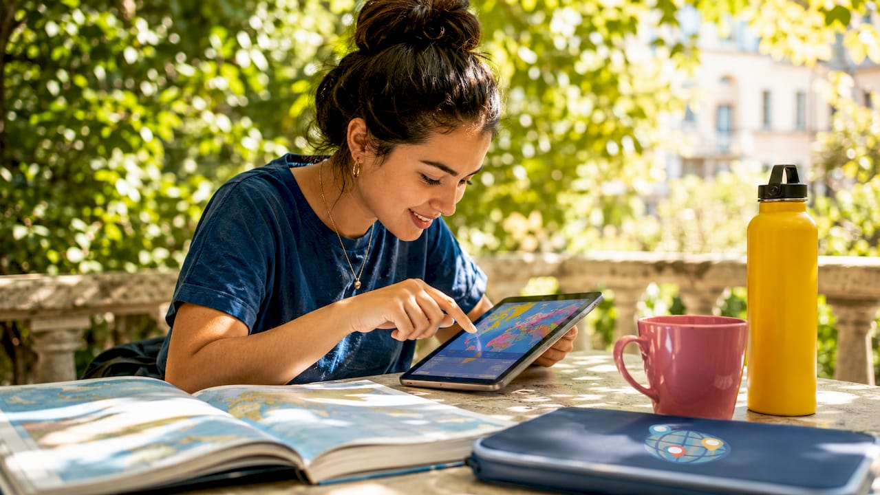
Click a country, get told you’re wrong, click again — that loop teaches geography better than any page you ever stared at in a textbook. Map-based quiz games make the map itself the thing you play, not just a picture sitting behind the questions. Platforms like Seterra, GeoGuessr, and Sporcle proved the point years ago: geography sticks when you click, guess, and compete in real time. Whether you’re building a lesson plan or chasing a high score, the right pick comes down to one thing — how fast the game tells you how close you got.
What makes map-based quiz games effective and engaging
The single biggest thing separating a good map quiz from a glorified flashcard is real-time scoring with instant feedback — right answers go green, wrong ones go red, and you know on the spot. No waiting for a results screen. That tight gap between mistake and correction is where the learning actually happens.
Variety matters just as much as speed. The good ones rotate — click a region, type a country name, pick from multiple choice — so you’re learning geography instead of memorizing where the buttons sit. Shuffle the order, track progress, and players have to genuinely know the answer rather than pattern-match their way through.
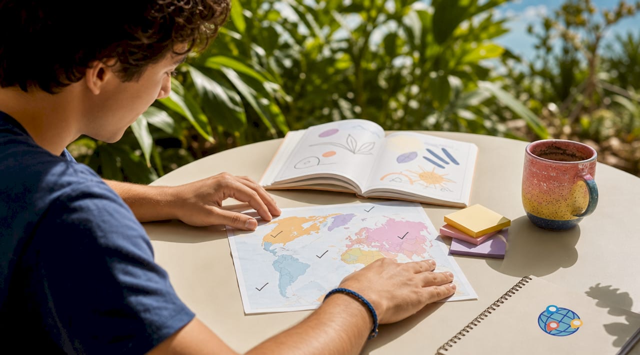
The best games pile on context. Spotting Egypt on a map is fine — spotting Egypt and seeing its capital, flag, population, and a quick historical hook is a lesson. Some challenges require identifying up to 30 countries across a single run, stacking several learning layers into one sitting. That depth is the line between a time-killer and a real study tool.
Interface design is the quiet one nobody notices until it’s bad. Clean map rendering, readable labels, decent color contrast — that’s what decides whether you stay ten minutes or bail in ten seconds. Students need clarity and study aids; trivia fans want timers and a leaderboard. Build around whichever one you actually have.
Quick tip: decide up front whether you’re after retention or competition. Study-minded players get the most from metadata overlays and progress tracking — competitive ones want timed rounds and score multipliers. Guessing wrong here is why people bounce.
Top examples of map-based quiz games
Here are the strongest ones worth your time, each doing geography a little differently.
1. Seterra
Seterra is the old reliable — over 40 languages, covering countries, capitals, flags, oceans, and continents, from gentle beginner up to genuinely hard. The click-on-map format is fast and uncluttered, with nothing pulling your eye off the geography. It’s lasted this long because it nails the basics: accurate content, zero friction. Get those right and players come back.
2. GeoGuessr
GeoGuessr plays a completely different game. It drops you into street view and asks where on Earth you are, so you’re reading road signs, vegetation, and architecture — not clicking a labeled outline. Learn to call a country from its bollards and signage, and you’ve internalized geography on a level no blank map ever reaches. It makes geography feel like an adventure, which is exactly why exploration-minded players love it.
3. Sporcle map quizzes
Sporcle is the giant library — thousands of map quizzes, from naming countries to untangling whole continents, for every skill level there is. Because the community builds them, new ones land constantly, including oddly specific stuff like landlocked countries, island nations, and historical borders. Handy for teachers who’d rather assign a quiz than build one from scratch. Sheer breadth is the whole pitch.
4. Educaplay Map Quiz Maker
Educaplay is built for teachers. Upload your own map, define the clickable regions, set the answers — no code anywhere. If you teach regional geography, historical territories, or anything map-shaped that’s specific to your lesson, you can shape every piece of it. That control is why it wins in actual classrooms.
5. Lizard Point Quizzes
Lizard Point runs over 200 quizzes on countries, states, cities, and flags, with the gamification stripped out — no leaderboards, no timers, just clean practice. It suits students grinding a specific region for a test or a geography competition. Quiet, deep, and made for repetition.
6. Worldlecity daily city guesser
Worldlecity turns a city into a daily guessing game — you get a photo of a mystery city and six guesses to name it. Every guess comes back with how close you are and which direction to head, so you’re thinking about where cities actually sit on the globe, not just rote-learning names. For teachers, the four difficulty modes stacked on the daily puzzle give you a real progression path — something a single random daily can’t do. Work up the tiers and the geography sticks.
7. Hostinger’s no-code map quiz builder
Want to build your own? AI-assisted no-code builders let you spin up a custom geography game with real-time scoring, leaderboards, and visual feedback — no developer required. It’s a good fit when your quiz has to match a specific curriculum map, like a state’s county boundaries or a long-gone empire’s territory. You keep full control over question format, difficulty, and how much metadata you pile on.
8. IRC world maps quiz
The International Rescue Committee’s world maps quiz teaches through context — silhouettes, neighboring countries, landmark cues — instead of making you stare at an isolated blank shape. If blank-map recall trips you up, those surrounding anchors give your memory something to grab. It also folds in historical and humanitarian facts, which gives it a point beyond the score.
Comparing map quiz games: features, usability, and audience fit
Which one you pick depends on what you need it to do. Quick comparison of the platforms above:
| Platform | Quiz format | Feedback type | Best for | Difficulty options |
|---|---|---|---|---|
| Seterra | Click on map region | Instant color feedback | Students, self-study | Multiple levels |
| GeoGuessr | Street view location pinning | Score based on distance | Gamers, explorers | Varies by map |
| Sporcle | Type or click answers | Score at end | Trivia fans, all levels | Wide range |
| Educaplay | Custom click regions | Configurable | Educators, classrooms | Fully customizable |
| Lizard Point | Click on map | Immediate correct/wrong | Students, test prep | Region-specific |
| Worldlecity | Photo-based city guessing | Proximity and direction | Gamers, students | Four difficulty tiers |
Timers, multipliers, and leaderboards turn a quiz into a competition, and that’s what keeps people replaying. Sporcle and GeoGuessr lean hard into that layer. Seterra and Lizard Point go the other way — clean study, no social noise. Worldlecity sits between the two: casual daily play up front, structured difficulty tiers underneath for anyone teaching with it.
Creative map quiz game ideas for educators and developers
Picking a quiz on purpose beats grabbing the most popular one. Whether you’re building from scratch or bending an existing platform to a lesson, a few ideas worth stealing:
- Thematic regional quizzes. Wall off one continent, one era, or one geopolitical theme. A quiz on only post-Soviet states, for example, teaches political geography and history in the same breath.
- Fuzzy answer matching. Fuzzy matching algorithms accept the obvious misspellings and alternate country names, so players don’t lose points for fat-fingering a name they actually knew. Skip it and you’re punishing typos, not ignorance.
- Flashcard integration. Pair a map quiz with flashcards on the same region and you hit visual and verbal memory at once. A Quizlet set running alongside a Seterra session does this nicely.
- Live multiplayer rounds. Run it as a live classroom event, everyone on the same question at the same time. Solo study just can’t manufacture that kind of energy.
- Difficulty progression paths. Tune difficulty by region and question type. Start students on continent-level identification, then countries, then capitals, then flags — let them climb.
- Historical map overlays. Drop in maps from different time periods so students see that borders move. That’s a critical-thinking layer most geography quizzes never bother with.
Quick tip: if you’re designing for a classroom, bake in at least three difficulty tiers from day one. Students who clear the easy level need somewhere to go, or they check out. Worldlecity’s four-tier structure is a clean model to copy.
Key takeaways
The map quiz games that actually teach share three traits — instant feedback, mixed question formats, and design built for a specific audience. The rest is decoration.
| Point | Details |
|---|---|
| Feedback drives retention | Instant color-coded responses and proximity scores accelerate learning more than end-of-quiz summaries. |
| Platform choice depends on goal | Educators need customization tools like Educaplay; gamers benefit from immersive formats like GeoGuessr. |
| Difficulty tiers matter | Structured progression from easy to hard, as seen in Worldlecity, builds knowledge more reliably than random daily challenges. |
| Fuzzy matching reduces dropout | Accepting minor typos and alternate names keeps players engaged and focused on geography, not spelling. |
| Metadata deepens learning | Quizzes that surface capitals, flags, and historical facts alongside map identification produce stronger retention. |
Why I keep coming back to map-based quiz games
I’ve spent years testing geography quiz tools — for myself and to recommend to teachers — and the pattern never changes: the games that feel most like games produce the best learning. GeoGuessr taught me more about Central Asian road infrastructure than any textbook I was handed in school. Seterra drilled West African capitals into me through sheer clean repetition. What neither does well is give a struggling student a clear path from beginner to advanced.
That’s the gap difficulty tiers fill. Looking at Worldlecity’s four modes stacked on the daily guesser, I recognized something most platforms skip entirely — the plain fact that learners don’t all start on the same level. Someone who can’t reliably place continents shouldn’t get the same quiz as someone who can name every capital in Southeast Asia. The tiers respect that.
So, honestly: use Seterra or Lizard Point for systematic coverage, GeoGuessr for engagement and exploration, and a tiered platform like Worldlecity for structured progression. Nothing does all three. The best geography programs I’ve seen just combine two of them.
— A WorldleCity editorial member
Try Worldlecity for daily geography challenges
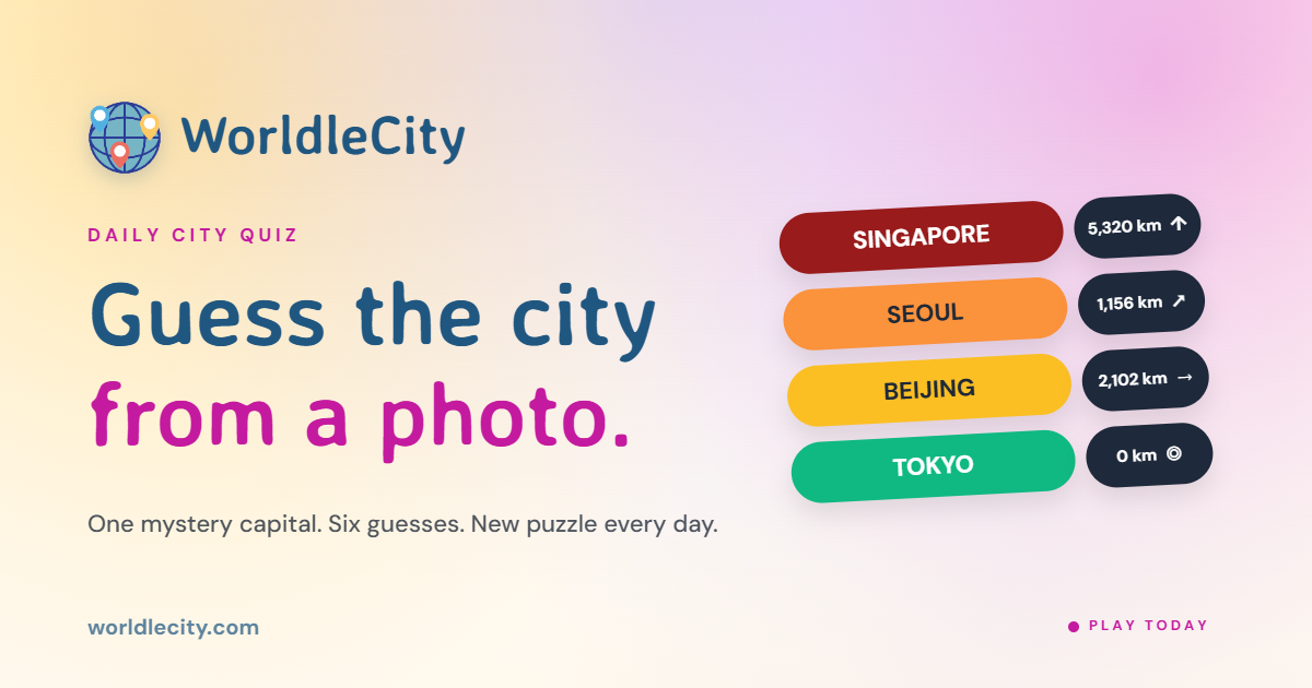
Worldlecity is a free daily city guessing game — a photo of a mystery city, six guesses, with proximity and direction after each one. The part that helps students: the difficulty-based mode stacks four levels, so learners build up instead of getting thrown straight into the hard stuff. No account needed, and results share straight to classmates or friends if you want the social nudge. Want to test your geography or hand your students a structured challenge? start playing on Worldlecity today.
FAQ
What are map-based quiz games?
Map-based quiz games are interactive digital tools where players identify locations, countries, capitals, or landmarks directly on a map interface. They combine geography education with game mechanics like scoring, timers, and feedback to make learning more engaging.
Which map quiz game is best for classroom use?
Educaplay’s Map Quiz Maker is the strongest option for educators because it allows fully customizable quiz creation without coding. Worldlecity’s difficulty-tiered quizzes also work well for structured student progression from beginner to advanced levels.
How does GeoGuessr differ from traditional map quizzes?
GeoGuessr uses street view imagery rather than labeled map outlines, asking players to identify their location based on visual environmental cues. This trains spatial reasoning and real-world geography recognition rather than rote map memorization.
Why does fuzzy answer matching matter in map quiz games?
Fuzzy matching accepts minor typos and alternate country names, preventing players from losing points for spelling errors rather than geography mistakes. Without it, rigid input validation causes frustration and player dropout.
Can map quiz games work for all age groups?
Yes. Platforms like Seterra offer multiple difficulty levels and are available in over 40 languages, making them accessible for young students through adult learners. Sporcle’s range from simple country naming to complex continent challenges, covering every skill level.