How to Identify European Cities from a Skyline Photo
Learn how to identify European cities from a photo of their skyline with our guide. Master visual clues and impress your friends today!
- Identifying architecture in photos
- European skyline recognition
- Identify city skylines
- Famous European city landmarks
- How to recognize city skylines
- Skyline photos of Europe
- European cities from images
On this page

Skyline identification is the practice of recognizing a city’s location from its visual profile alone, using architectural shapes, landmark silhouettes, and environmental context as your primary evidence. You can identify European cities from a photo of their skyline by reading the right clues: the curve of a river, the silhouette of a cathedral, or the density of a financial district tells you more than you might expect. This guide walks you through the visual signals, the AI tools, and the step-by-step methods that experienced geolocators use, so you can go from “I have no idea” to “that’s definitely Frankfurt” in a matter of minutes.
What visual and architectural clues reveal a European city skyline?
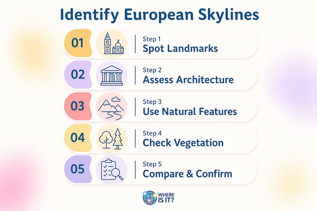
European skylines have a personality that American or Asian skylines simply do not share. Most European city centers are low and horizontal, punctuated by a single dominant spire or tower rather than a wall of glass skyscrapers. When you see a skyline photo where one gothic cathedral or baroque dome rises above everything else, you are almost certainly looking at a European city.

Landmark silhouettes as instant identifiers
A handful of European cities are immediately recognizable from their skylines. Paris has La Défense’s cluster of modernist towers offset against the Eiffel Tower. London’s Canary Wharf produces a tight, American-style cluster that stands apart from the older city. Frankfurt is the only German city with a true Manhattan-style skyline, earning it the nickname “Mainhattan.” These three cities are outliers. Most European cities rely on a single iconic structure, which makes that structure your fastest clue.
Architectural style and urban layout
European cities built before the 20th century share a recognizable urban grammar. Block courtyards, narrow street grids, and consistent building heights of four to seven stories define cities like Vienna, Prague, and Amsterdam. When you spot a skyline with uniform rooflines and ornate facades, you are looking at a pre-industrial European core. The Oxford architecture stories behind cities like Oxford illustrate how Gothic spires and honey-colored stone create a skyline fingerprint that is nearly impossible to fake.
Natural features and lighting as geographic clues
Rivers, mountains, and coastlines narrow your search dramatically. Prague sits on the Vltava. Budapest straddles the Danube with a parliament building on one bank and a castle on the other. Lisbon tumbles down hills toward the Tagus estuary. Beyond geography, shadow direction and length can estimate time of day and latitude, helping you distinguish between a Nordic city with low-angle winter light and a Mediterranean city with harsh midday shadows. This single technique can cut your candidate list in half before you look at a single building.
Pro Tip: Look at the vegetation in the photo. Palm trees mean Mediterranean. Birch and pine mean Scandinavia. Deciduous trees with dense canopy suggest Central Europe. Plants do not lie.
Which digital tools and AI technologies help with skyline identification?
Modern AI has turned skyline identification from a specialist skill into something anyone can attempt. The tools below range from consumer-friendly to technically sophisticated.
- Google Lens is the fastest starting point. Drag your cropped skyline image into Google Lens and it will return visually similar images, often with city names attached. It works best when you isolate a distinctive building rather than uploading the full panorama.
- GeoSpy AI is purpose-built for photo geolocation. It analyzes environmental and architectural features to suggest probable locations, even without any metadata attached to the image.
- Locus is an open-source AI geolocation system that uses FAISS vector search and ResNet50 to narrow thousands of candidate locations down to five to ten options for human review. Think of it as a very fast first filter, not a final answer.
- TerraSky3D is a dataset of 50,000 landmark images that enables AI models to recognize landmarks from unusual angles and lighting conditions, overcoming the limitations of flat 2D training data.
How accurate are these tools?
| Tool | Primary method | Typical accuracy |
|---|---|---|
| Google Lens | Visual similarity search | High for famous landmarks |
| GeoSpy AI | Environmental feature analysis | Strong for urban scenes |
| Locus | FAISS vector search + ResNet50 | Narrows to 5-10 candidates |
| Hybrid AI models | Multi-modal data fusion | Over 68% within 200m across Europe |
Advanced hybrid AI models can localize images within a 200-meter radius for more than 68% of queries in European datasets. That is genuinely impressive, but it also means roughly one in three queries will land you in the wrong neighborhood. Human verification is not optional.
AI tools also struggle with the domain gap between ground-level and aerial views, which is why the best systems now integrate ground photos, aerial imagery, and 3D datasets together. The practical takeaway: use AI to generate candidates, then confirm with your own eyes using Google Maps Street View.
How to manually identify European cities from skyline photos
Manual photo location workflows typically take 30 to 60 minutes and follow a consistent sequence. Here is the process that experienced geolocators use.
-
Check the photo metadata first. If the image has not been stripped of EXIF data, GPS coordinates may already be embedded. Right-click the file, open Properties or Get Info, and look for location data. This takes 30 seconds and occasionally solves the whole puzzle instantly.
-
Crop to your strongest visual feature. Do not feed the entire panorama to any AI tool. Cropping to isolate static, high-contrast architectural elements improves AI recognition accuracy significantly. A unique bridge arch, a distinctive spire, or an unusual tower shape will return far better results than a wide cityscape.
-
Run Google Lens on the cropped image. Look at the top image matches and note which cities appear repeatedly. If Prague’s Charles Bridge appears in three of the top five results, you have a strong lead.
-
Analyze shadows, vegetation, and infrastructure style. Once you have a regional candidate, use shadow direction to confirm latitude. Check whether the street furniture, road markings, and building materials match your candidate city. Nordic cities use specific bollard styles. Southern European cities favor terracotta rooflines. These details are stable across decades.
-
Confirm with Google Maps satellite and Street View. Find the approximate location on Google Maps, switch to satellite view, and look for the building cluster you identified. Then drop into Street View to compare ground-level details against your photo. This is your final verification step.
Pro Tip: When you are stuck, search Google Images using the city name plus “skyline” and compare the horizon profile. The relative height and spacing of buildings in a skyline is as distinctive as a fingerprint once you train your eye.
For a deeper look at the full photo identification process, the practical city photo guide on the Worldlecity blog covers additional techniques for both urban and street-level images.
Common mistakes when identifying city skylines and how to fix them
Even experienced geolocators get tripped up by the same recurring problems. Knowing these pitfalls in advance saves you significant time.
- Trusting the skyline alone. Skylines change. New towers go up, old ones come down. Micro-clues like bollard styles, sidewalk textures, and street sign typefaces provide more consistent location markers than the skyline itself. A building that defined a city’s profile in 2010 may be dwarfed by 2026.
- Confusing similar landmarks. Several European cities have red-brick gothic town halls that look nearly identical in a skyline photo. Brussels, Hamburg, and Stockholm all have prominent waterfront halls. Do not commit to a city based on one building type alone.
- Uploading the full image to AI tools. This is the single most common technical mistake. AI tools perform best on isolated features. A full panorama introduces too many competing elements and dilutes the signal.
- Ignoring the foreground. The foreground of a skyline photo often contains the most stable clues: a specific bridge railing design, a tram line, a particular paving stone pattern. Effective location identification relies more on systematically eliminating possibilities using micro-clues than on immediate skyline recognition.
- Stopping at one source. AI tools narrow thousands of options to five to ten candidates for human review. Never accept a single AI result as definitive. Cross-reference with Google Maps, Wikipedia’s city skyline images, and Street View before you commit.
“Even the most photogenic European skylines can be misleading due to rapid urban development. Experienced geolocators prioritize details unlikely to change, such as street furniture and pavement types.” — PlaceSpotter GPS Guide
The domain gap between perspectives is a real technical challenge even for AI systems, which is why multi-modal verification always beats single-source confidence.
Key takeaways
Identifying European cities from skyline photos requires combining visual literacy, systematic elimination, and AI-assisted verification rather than relying on any single method alone.
| Point | Details |
|---|---|
| Start with landmarks | Famous silhouettes like La Défense or Canary Wharf give instant regional context. |
| Use micro-clues over skylines | Bollards, paving, and signage fonts are more stable identifiers than building profiles. |
| Crop before using AI | Isolating one architectural feature dramatically improves AI recognition accuracy. |
| Verify with Street View | Always confirm AI candidates using Google Maps satellite and Street View. |
| Shadow analysis narrows latitude | Light angle and shadow length help distinguish Nordic from Mediterranean cities. |
Practice your skyline skills with Worldlecity
Reading about skyline identification is one thing. Actually doing it under a little friendly pressure is where the skill really sticks.
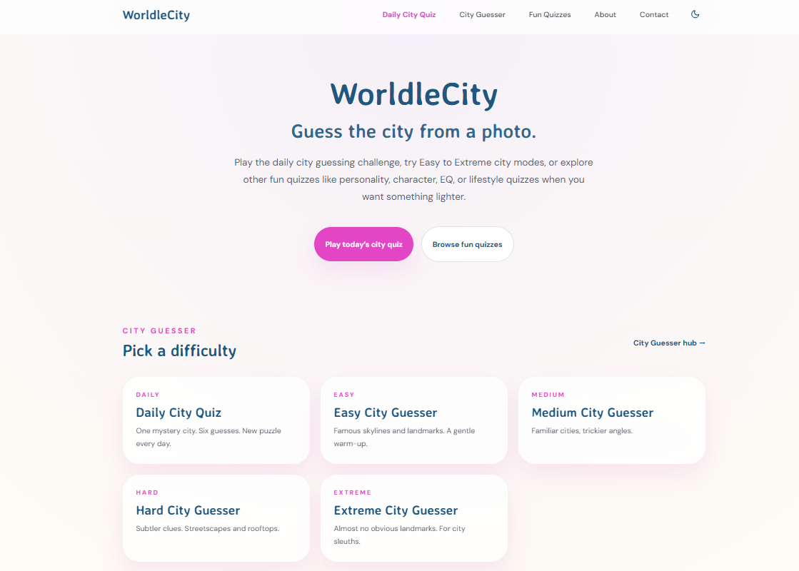
Worldlecity drops a new mystery city photo on you every day, and you get six attempts to name it. Each wrong guess tells you how far off you are and in which direction, so you are actively building your mental map of European cities with every play. The platform also offers city guesser quizzes across four difficulty modes, from recognizable capitals to genuinely tricky mid-size cities that will test even seasoned travelers. No account needed. Just show up, look at the photo, and start reading the clues. If you want to explore more ways to sharpen your geography instincts, the map-based quiz games guide on the Worldlecity blog is a solid next stop.
FAQ
What are the easiest European city skylines to recognize?
Paris, London, and Frankfurt are the most immediately recognizable because each has a distinctive cluster of modern towers combined with a famous landmark. The Eiffel Tower, the Canary Wharf group, and Frankfurt’s “Mainhattan” skyline each have a profile that appears in almost no other European city.
Can AI identify a city from a skyline photo without GPS data?
Yes. Tools like GeoSpy AI and Locus analyze architectural and environmental features rather than metadata. Hybrid AI models achieve over 68% accuracy within a 200-meter radius across European datasets, though human verification is still recommended for a confident final answer.
How long does manual skyline identification take?
Manual workflows typically take 30 to 60 minutes and involve metadata checking, visual feature extraction, AI-assisted search, and map confirmation. Experienced geolocators can move faster by going straight to micro-clues rather than spending time on the skyline itself.
Why do micro-clues work better than skylines for city identification?
Skylines change frequently as cities develop, while street furniture, pavement types, and signage fonts remain consistent for decades. Micro-clues eliminate candidate cities faster and are less likely to mislead you when a city has added new towers since a photo was taken.
How do I improve my ability to recognize city skylines over time?
Daily practice with real photos is the fastest method. Playing a recognizing city skylines quiz, like the daily game on Worldlecity, trains your eye to pick up on the subtle differences between European cities through repeated exposure and immediate feedback on each guess.