How Airports Reveal City Identity in Photo Quizzes
Discover how airports shape city identity in photo quizzes by revealing essential clues, from architecture to environmental cues.
- role of airports in city identity
- how airports shape city image
- airports as cultural landmarks
- airport photo identification
- city-guessing quiz clues
- wayfinding and airport design
On this page
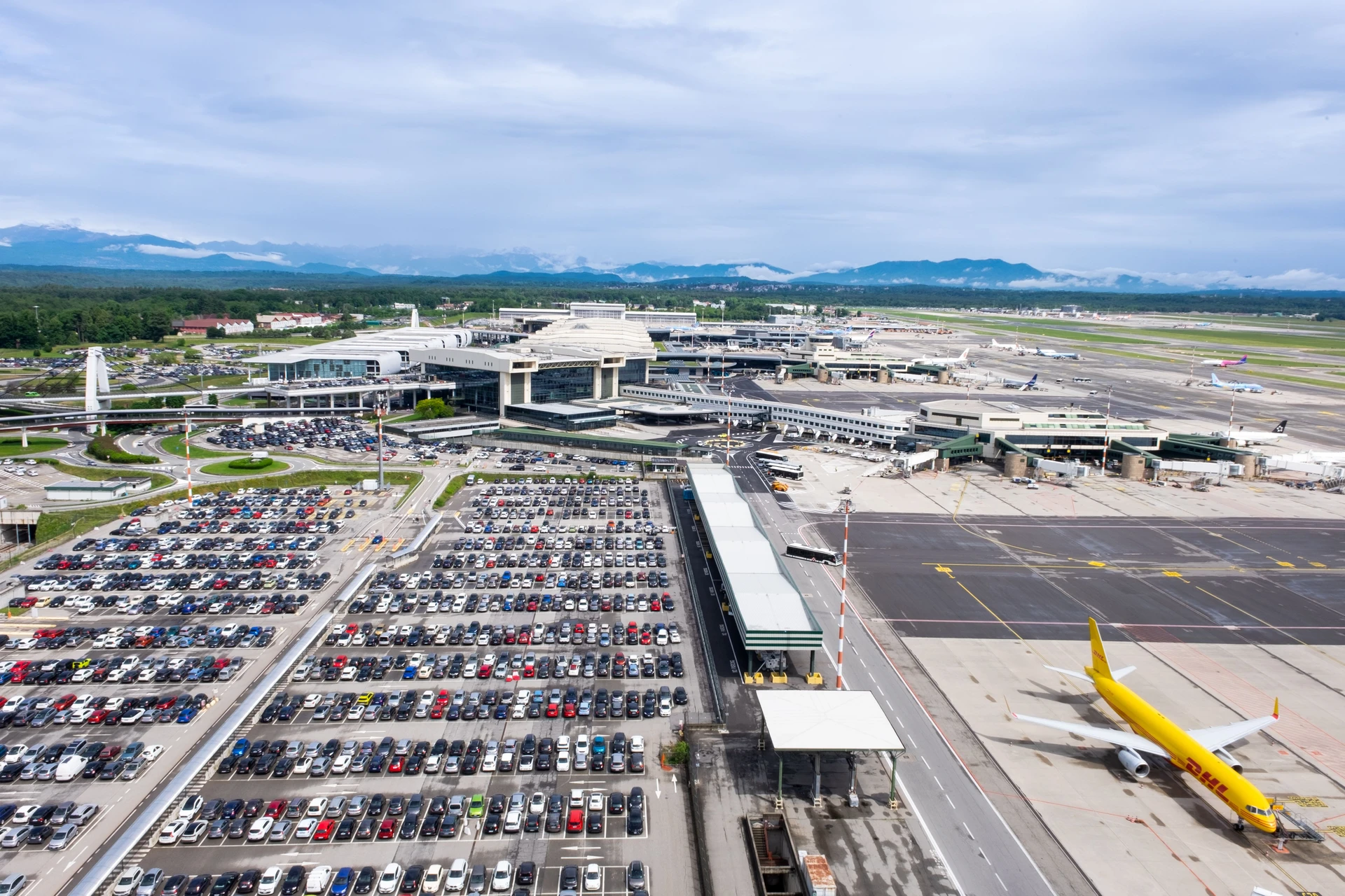
Airports are one of the fastest city-identification clues in any photo quiz because they layer four independent signal types into a single frame: environment (terrain and vegetation), signage and language, terminal architecture, and aircraft liveries on the tarmac. Spot two of those agreeing, and you can usually lock in a region within seconds. Spot three, and you’re often at the city level.
The four fastest clues to scan first are:
- Environment: palm trees, snow-capped peaks, red-rock desert, or dense conifers each eliminate entire continents instantly
- Signage: script, color palette, and typeface narrow you to a country or language zone
- Terminal layout: roofline shape, hanging signs, pillar spacing, and ticket-counter runs encode a design culture
- Aircraft concentration: a gate full of one carrier’s livery is a near-direct pointer to that airline’s hub city
Key takeaways
Airports are among the highest-signal photo clues in city-guessing games because they layer environment, signage, architecture, and aircraft into one frame — and two agreeing clues are usually enough to confirm a location.
| Point | Details |
|---|---|
| Environment comes first | Terrain and vegetation eliminate entire continents in 2–3 seconds before you read a single sign. |
| Script beats Latin signage | Non-Latin scripts (Hangul, Arabic, Cyrillic) are the fastest single clue in the checklist. |
| Runway geometry confirms cities | Runway count, angles, and coastal context cut the global candidate list to single digits. |
| Two clues agreeing = confidence | Verification of nearby structures is the standard check before committing to a city. |
Why airports give you so many city clues at once
A random street photo might show you a sidewalk and a shop front. An airport photo shows you the sky, the horizon, the vegetation line, the terminal skin, the signage system, and a dozen aircraft tails — all in one shot. That density is why airports matter so much to quiz players.
Wayfinding research at Vienna International Airport found that passengers consistently use the same spatial schemata — verticality (hanging signs), path (counter runs), and collection (pillar clusters) — to orient themselves. Those patterns are reproduced across airports worldwide because designers follow the same wayfinding logic, which means they also function as reliable perceptual fingerprints for identification. Vienna International Airport appears in wayfinding image-schemata research as a case study precisely because its architectural cues (ceiling-hung signs, linear counter runs, pillar placement) are so consistent that passengers navigate by pattern recognition alone.
Experienced guessers treat environment first, signage second. A visible mountain range rules out Florida faster than any sign ever could. Lush tropical groves eliminate the arid American Southwest in under two seconds. Only after the terrain check does it make sense to zoom into letters and logos.
Airline-hub concentration adds a third fast layer. When you see gate after gate of the same livery, experienced players call it a near-certain hub indicator — a shortcut that cuts the candidate list from dozens of cities to a handful.
What to scan and in what order
Here’s the priority stack, from broadest exclusion to finest resolution:
- Terrain and vegetation (continent/hemisphere): palms point to tropical or subtropical; conifers to temperate or boreal; scrub and red soil to arid zones
- Signage color and script (country or language zone): Arabic script, Cyrillic, Hangul, or Latin each carve out distinct geographies; color-coded wayfinding systems vary by national design tradition
- Terminal architecture (country or region): roof curvature, glass-to-wall ratio, pillar style, and hanging-sign density reflect local construction norms
- Aircraft liveries and tarmac density (city or metro): hub concentration narrows to specific carrier bases
- Runway geometry and aerial footprint (city confirmation): runway count, angles, and coastal or reclaimed-land placement are highly distinctive visual signatures once you’ve trained your eye on satellite airport layouts
- Cultural interior elements (city or neighborhood): murals, local art installations, regional retail brands, and billboards carrying local businesses’ names are the finest-grained clues
| Clue type | Speed | Geographic resolution | Best verification |
|---|---|---|---|
| Terrain and vegetation | 2–3 sec | Continent / hemisphere | Satellite view |
| Signage script and color | 5–8 sec | Country / language zone | Street View |
| Terminal architecture | under a dozen seconds | Country / region | Wayfinding research |
| Aircraft liveries | 5–10 sec | City / metro (hub) | Airline route maps |
| Runway geometry | 10–15 sec | City (confirmation) | Satellite overhead |
| Cultural interior elements | under half a minute | City / neighborhood | Local knowledge |
Pro Tip: When signage is absent or obscured, shift to runway geometry. Axis-aligned parallel runways suggest flat inland airports; angled or staggered runways often indicate coastal or terrain-constrained sites. Denver’s pinwheel layout and Tokyo Haneda’s reclaimed-land configuration are recognizable from satellite alone.
Wayfinding design experts note that angled ticket counters, floor grids, and hanging signage encode a country’s design philosophy unconsciously, which is exactly why those features work as location signals even when you can’t read the text.
How to run a 30-second airport-scan in-game
This sequence works whether you’re playing a timed round or a relaxed daily quiz. Run it top to bottom, stop when two clues agree.
- Seconds 0–3: horizon and vegetation. What’s behind the terminal? Mountains, palms, flat grassland, or snow? Rule out entire continents before touching anything else.
- Seconds 3–8: signage script and color. Can you read the alphabet? Is it Latin, Cyrillic, Arabic, or logographic? What color is the wayfinding system? This step alone often gets you to a country.
- Seconds 8–14: terminal skin and roofline. Glass curtain wall or concrete? Curved roof or flat? Hanging ceiling signs or wall-mounted? These architectural schemata are consistent enough to suggest a design culture.
- Seconds 14–20: aircraft tails. Count how many share the same livery. A dominant carrier at multiple gates is a hub signal. Cross-reference with known airline bases.
- Seconds 20–25: runway geometry (if aerial view). Parallel, angled, or pinwheel? Coastal reclamation visible? Runway and terminal geometry produce detectable visual features that narrow the field fast.
- Seconds 25–30: cultural interior details. Local art, regional brands, or language-specific retail signs are your tiebreaker. Then run a reverse-image search and verify with satellite view if you’re still unsure.
Quick checklist for in-game use: horizon → script → roofline → tails → runway → interior → verify.
Applying the scan to real airport photos
Vegetation rules out a continent
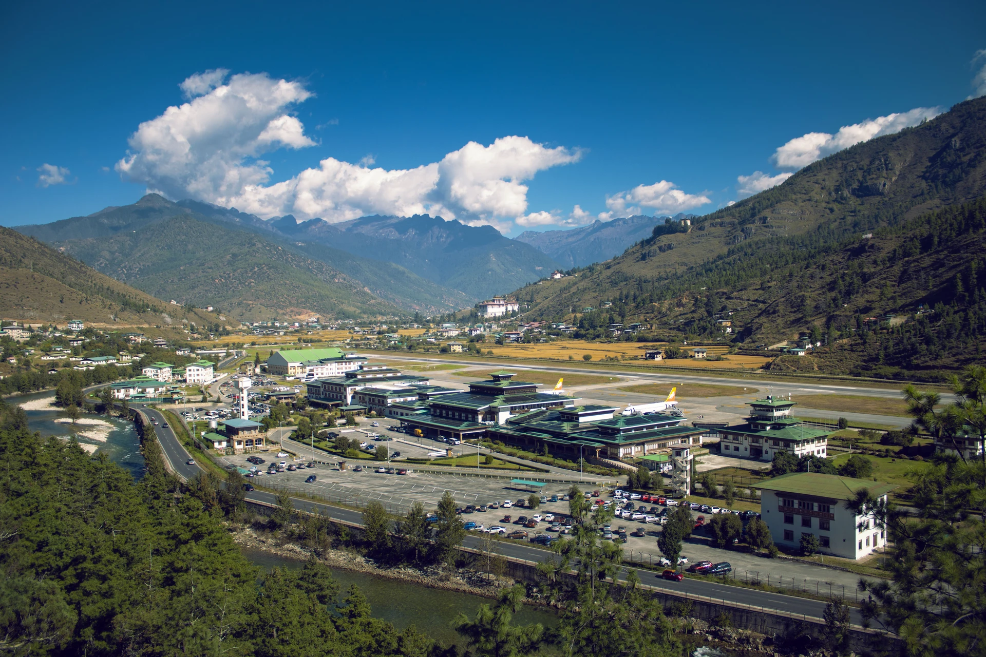
Photo shows a short runway pinned into the floor of a narrow valley, with steep pine-covered slopes rising almost vertically on both sides and terraced fields cut into the lower hillsides. No flat horizon anywhere in frame. The scan hits terrain first: dense conifer forest and near-vertical valley walls rule out flat, coastal, or desert airports immediately and point to a high-altitude mountain range. The terracing pattern narrows the field to a small set of high-altitude Himalayan valley airports. Lesson: valley geometry and forest type together outperform signage when the script alone can’t isolate a single country.
Typeface and script identify a country
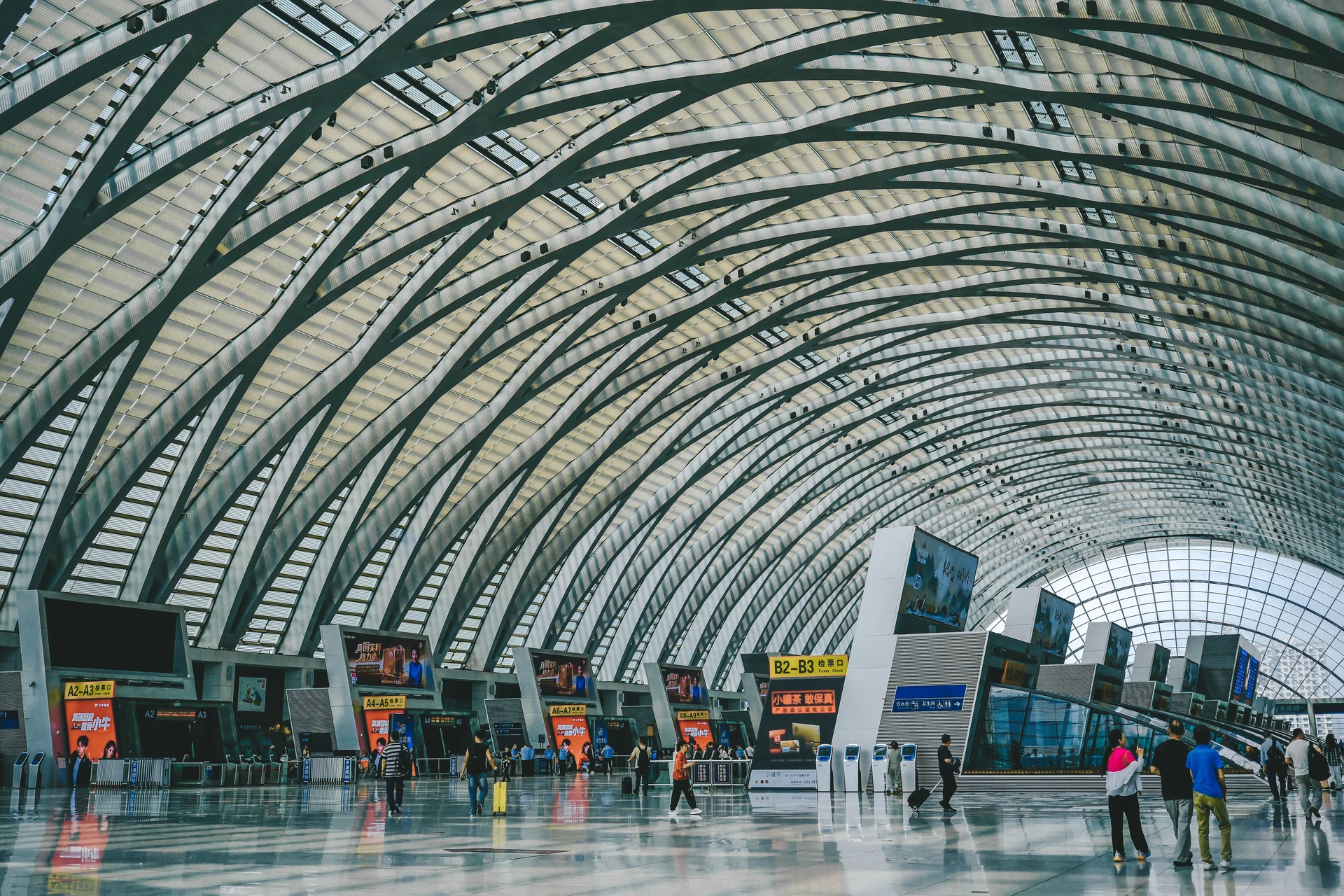
Photo is interior: a long ticket-counter run, ceiling-hung signs, and a color-coded wayfinding system in green and white. The script mixes Hangul and English. That single detail eliminates every non-Korean airport. The green-and-white palette matches a known Korean airport color system. Two clues agree; the country is confirmed in under ten seconds. Lesson: non-Latin scripts are the fastest single clue in the entire checklist.
Runway geometry reaches a city
Aerial photo shows two parallel runways with a third at an angle, surrounded by reclaimed land and water on three sides. Runway count, angles, and coastal context are reliable memorized signals. The reclaimed-land geometry combined with the runway arrangement matches a small set of Asian coastal airports. Lesson: runway geometry plus water context cuts the global list to single digits.
Things that can mislead you — and how to catch them
Several common features push players toward wrong answers. Here’s what to watch for:
- International airline presence at non-hub airports: a single wide-body jet from a major carrier does not make an airport a hub; look for concentration, not just presence
- Reused branded retail signage: global chains (duty-free shops, fast-food brands) appear in airports on every continent and carry zero location signal
- Artificially landscaped terminals: some airports import non-native plants for aesthetics, so a palm inside a terminal in a cold climate is not a vegetation clue
- Photo filters and color grading: heavy warm or cool filters can shift soil and vegetation tones enough to suggest the wrong climate zone
- Stock or promotional images: staged photos sometimes composite terminal interiors with unrelated exterior backgrounds
The counter-check is always the same: observe multiple clues, run a reverse-image search, then verify with satellite view. Two or three independent clues agreeing is the threshold for confidence.
Pro Tip: Before you commit to a city, pull up satellite view and compare the tarmac shape and building footprint to your candidate airport. A 15-second overhead check catches most false positives that slipped past the ground-level scan.
A two-week plan to sharpen your airport-spotting skills
Accuracy first, then speed, then mixed-mode rounds. That progression is what builds durable pattern recognition rather than lucky guesses.
Week 1: build the pattern library
- Day 1–2: spend 10 minutes on runway geometry flash drills — reveal runways only, guess the airport, then add taxiways and buildings to confirm.
- Day 3–4: run 10 reverse-image hunts on airport photos you find on travel forums; write down which clue cracked each one.
- Day 5–6: study airline hub maps for three major carriers; quiz yourself on which cities each dominates.
- Day 7: timed round — 30 seconds per photo, no verification. Record your hit rate.
Week 2: build speed under pressure
- Day 8–9: repeat the runway drills but cut reveal time to 5 seconds per image.
- Day 10–11: focus on signage-only drills — cover the environment and aircraft in each photo, identify by script and color alone.
- Day 12–13: mixed-mode rounds using visual clues in geography quizzes — alternate between aerial and ground-level photos.
- Day 14: full timed session on Worldlecity’s daily city-guessing mode. Aim to beat your Week 1 hit rate.
Targets to track:
- Week 1 end: identify the correct continent from terrain alone in under 5 seconds
- Week 2 end: reach city-level identification in under 30 seconds on at least half your attempts
Worldlecity is your daily practice arena
If you want to put this scan method to work immediately, Worldlecity’s daily city-guessing game is the fastest way to get reps in. Each day’s photo drops you into a mystery city with six guesses and directional feedback after each one — exactly the kind of pressure that trains the 30-second scan into muscle memory.
Worldlecity also offers difficulty-based city guessing rounds for those who want more than a single daily dose. The four difficulty modes map directly to the training plan above: start on the easiest setting to build your pattern library in Week 1, then push to harder modes in Week 2 when you’re chasing speed. No account needed. You can be mid-drill in under a minute. Try a 10-minute warm-up session on Worldlecity today and see how far down the candidate list your airport scan gets you.
Sources
The research and resources below back the advice in this guide and are worth bookmarking for deeper practice.
- Guess that airport: My secrets for winning (almost) every time - CNET
- Wayfinding image schemata analysis (Vienna International Airport) - Raubal et al.
- Recognizing airports from high-resolution optical images using saliency and BOVW - MDPI
- How to Find Where a Photo Was Taken: 5 Proven Methods (2026) | Where Is This Place?
- Runway Guesser: Can You Identify Airports From Above? | Jere Codes
FAQ
What makes airports such reliable clues for city guessing?
Airports concentrate multiple independent signal types — terrain, signage, architecture, and aircraft — into one photo, making them faster to read than most street or landscape shots. Two agreeing clues are usually enough to confirm a location.
Which airport clue should you check first?
Start with terrain and vegetation; they eliminate entire continents in under three seconds. Experienced guessers prioritize environment over signage because a mountain range or palm grove rules out large regions before you’ve read a single letter.
How does runway geometry help identify a city?
Runway count, angles, and coastal or reclaimed-land context are highly distinctive identifiers that can cut the global candidate list to single digits. Layouts like Denver’s pinwheel or Tokyo Haneda’s reclaimed-land configuration are recognizable from satellite view alone.
How do you avoid false positives in airport photos?
Check for clue agreement rather than relying on one feature. International airline presence, reused retail signage, and artificially landscaped terminals are common misleaders. Always verify with a reverse-image search and satellite view before committing.
Where can you practice airport identification for city-guessing games?
Worldlecity’s daily city-guessing mode gives you a new photo every day with six attempts and directional feedback, making it a practical arena for the 30-second scan drills in this guide.